Wakhan Trip Day 6: A Taste of Winter in Bulunkul
24 September, 2008, 04:21 pm in "Tajikistan"

It is really cold here and the wind seems almost constant. Our hostess served milk rice kasha for breakfast which hit the spot. Then we ventured out into the cold wind to hike to Yeshil Kul (Green Lake). The sun was bright but its warmth couldn't penetrate the coldness of the wind. We tried to cut straight across the jailoo to get to the road which led up a mountain to the lake. A bit too late, we realized what we thought was mostly dry pasture, was swamp. We leaped from grassy island to island trying to avoid the muddy channels between. What we thought would be a shortcut was a snaking path which finally got us to dry land at the base of the hill.
From there everything became desert-like sandy dirt with pin-cushion cacti or scrubby brush only able to grow a few inches due to the harsh environment: wind, lack of water, freezing weather, and salt filled soil.
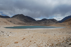
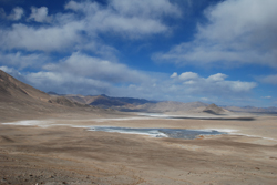
Climbing up the hill was a slow feat since the wind was against us and we are at a rather high altitude. Finally we reached the top and were able to look down at the lake. It was a slightly greenish blue with white caps stirred up by the wind.
At the base of the lake was a small warm pool-- clear with lots of water grasses growing in it. The wind didn't let up next to the lake so, after sitting a little, we returned back over the hill to Bulunkul.
The mountains around Bulunkul seem to have been marbled with red and orange pigments. Even without the warm evening light of yesterday, the colors still retained their richness.

Wakhan Trip Day 5: Plumbing, Petroglyphs and the Fatest Fat-Ass Sheep
23 September, 2008, 04:21 pm in "Tajikistan"
 Rowshan and I were discussing plumbing last night. This trip has really given me an appreciation of plumbing. All the places we've stayed in have had electricity of some sort at least for a few hours a day: solar batteries, gas generators, or rather limited local power. However, plumbing is a rare thing. The guest house in Ishkashim had it (flush toilets, shower and all!). The Pamir Lodge has an interesting system using a cascade of water behind the house and some how redirecting it into toilet, sink, irrigation canals and hoses. (though sometimes it seems to disappear entirely).
 But, everywhere else has just used water flowing through the town from canals, rivers and streams. The public toilet in Khorog, the largest town in the Pamirs is a set of nearly overflowing pit toilets. We miss flush toilets and showers. Some places have bathing rooms, water boilers (wood or electric powered) but others you get a bowl of hot water which you splash on yourself outside. We were wondering if the Russians had installed plumbing in places and now it just doesn't work. We see a lot of big metal water tanks sitting around next to houses as if waiting for some miracle to make them work. I suppose people living here don't miss what they've never had so maybe it isn't a priority for development. But it is so odd to see people with satellite TV but no plumbing.
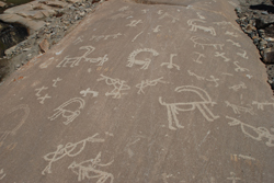
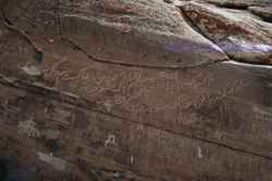
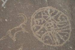
In the hills above Lenger are 100s of petroglyphs. The road towards them started out a shady path but soon became rocky sun drenched rock hills. It was a steep climb but we soon came to some large flat rock faces covered with petroglyphs ranging from older faded and partially covered mountain goats with giant horns to modern graffiti. It was hard to tell how old things were and I think a lot of the goats were contemporary copies of the older goats. There were also archers aiming at goats and the definitely more contemporary people with machine guns aiming at goats-- perhaps telling the sad story of the Marco Polo sheep being nearly hunted to extinction. Some of the goats had ridiculously huge horns.
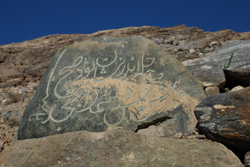
There were also a couple interesting circle patterns on one rock and hands. We were going to search the rock faces across a stream when a shepherd who was sitting near some rocks above us pointed to another rock face. This one was covered with layers of rock carvings including several in Persian. The shepherd said his grandfather had carved a couple of the Persian inscriptions, one marked 1938. There were horses and more goats. It was unfortunate that the older petroglyphs had been covered by newer carvings-- however they did show a continued obsession with large horned goats.
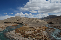
Leaving Lenger, we headed up into the mountains and North away from the section of the Wakhan Valley we'd been driving through previously. The river undulated below us and the trees echoed the undulations of previous strands of the braided river making their own yellow and green snake-like lines. Soon we were driving way above the river which became hidden in a deep river gorge, only occasionally appearing in a brief flash of turquoise.
At one point Zaher pointed out the road to Pakistan which was only about 30 km away through Afghanistan's narrow Wakhan Corridor. Instead of seeing flashes of white peaks through windows between the closer mountains, the mountains we drove next to seemed to close up like a wall with ridges on the top like crocodile teeth.
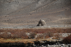
The mountains which were harsh and dry except for an occasional cascade of water. The gold and red bushes which followed the flow of the water seemed like spots of flame against the black rocks. We descended back to the river which had flowed from the gorge into flat open land. The river was so narrow that one could wade across it to Afghanistan. However, the are was so remote neither Tajikistan nor Afghanistan seemed worried about people going back and forth. A little further down the road across the river we did see a house that looked like a mud brick igloo.
The mountains which were harsh and dry except for an occasional cascade of water. The gold and red bushes which followed the flow of the water seemed like spots of flame against the black rocks. We descended back to the river which had flowed from the gorge into flat open land. The river was so narrow that one could wade across it to Afghanistan. However, the are was so remote neither Tajikistan nor Afghanistan seemed worried about people going back and forth. A little further down the road across the river we did see a house that looked like a mud brick igloo.
Then we saw a small group of people, a herd of yaks, as well as a couple buildings. But that was the only sign of life we saw on the Afghan side. On the Tajik side we passed a few occasional ruined buildings with windows filled in with bricks, perhaps old Russian military housing or border posts, now abandoned. We did see an occasional shepherd and one house in a green spot by a stream, but aside from that, the Tajik side was similarly unoccupied.
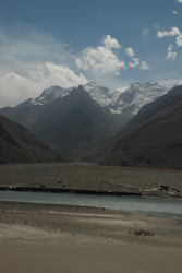
We came to the military base at Khargush and then turned away from the river into the dry hills. Even along the river, the landscape was so dry that it seemed like the river had given up trying to cast any shadow of greenness on it. The road ran along some small trickling streams which made a path of dry brown plant life through the rocks. A strong cold wind whipped through the mountains. As we rose into the mountains, we got a final view of massive snow-capped peaks of the Hindu Kush behind us. As we got higher, the clouds lifted and we were able to see vast fields of snow on the highest, largest of the peaks.
We came to the military base at Khargush and then turned away from the river into the dry hills. Even along the river, the landscape was so dry that it seemed like the river had given up trying to cast any shadow of greenness on it. The road ran along some small trickling streams which made a path of dry brown plant life through the rocks. A strong cold wind whipped through the mountains. As we rose into the mountains, we got a final view of massive snow-capped peaks of the Hindu Kush behind us. As we got higher, the clouds lifted and we were able to see vast fields of snow on the highest, largest of the peaks.
We passed a couple lakes and saw a few birds flit across the seemingly lifeless landscape. The second lake was surrounded by white powder-- salt or some other mineral deposit. We picked up a couple guys who had walked from Khargush through this unwelcoming landscape and gave them a ride to the Pamir Highway.
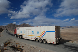
After all the rough dirt and gravel roads we've been on the past few days, it was a bit of a shock to come upon the smooth black line of pavement with a parade of trucks headed West towards Khorog. Below us was a broad flat plane with three lakes. Beyond were the Pamir mountains rising purple in the distance. Another contrast of flatness and mountains.
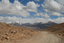
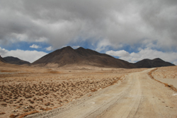
We didn't have long to enjoy the feeling of driving on smooth pavement. Soon we turned onto another dirt and rock road leading into the mountains. The road went through a flat area with mountains rising beyond it. Sometimes Zaher drove off the road because the ground was less rutted. A short drive brought us into a flat area almost surrounded by mountains. We drove across this plane towards a small cluster of buildings near (but not next to) the lake, Bulunkul.
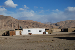
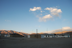
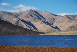
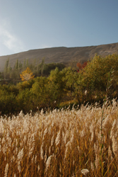
The town looked a bit like photos I've seen of Arctic villages--a few simple houses huddled together as if attempting to stay warm on a broad cold plain. We arrived in the late afternoon and the light made the colors rich. The dry grass was gold against red hills, deep blue lake, and clear light blue sky.
The town looked a bit like photos I've seen of Arctic villages--a few simple houses huddled together as if attempting to stay warm on a broad cold plain. We arrived in the late afternoon and the light made the colors rich. The dry grass was gold against red hills, deep blue lake, and clear light blue sky.
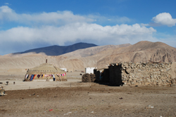
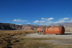
Walking through the town it seemed like we saw more cows on the street than humans. The people we did see were wrapped in warm clothes against the cold wind which whipped across the plain. Around the town we saw the skeletal remains of metal equipment: the metal tank of a truck, water tanks, cars stripped of everything and odd mysterious metal parts of some kind of vehicle or machine. It looks like Bulunkul is a place that vehicles come to die. We also saw a yurt in someone's yard, probably the first yurt we'd seen since Kyrgyzstan.
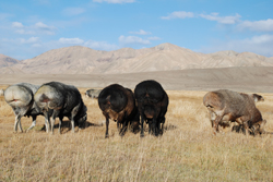
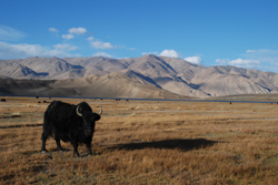
We walked across the dried pasture lands to the lake and came upon a flock of the fattest assed fat-ass sheep we'd ever seen. We stared in wonder and amazement as the huge fluffy animals wandered around us with their huge rear ends bouncing. With that, Tajikistan stole Kyrgyzstan's crown for fattest assed fat-ass sheep. Beyond the sheep were a herd of yaks. We walked through them to the lake side where water birds drifted on the surface.
Wakhan Trip Day 4: Yamg to Lenger
22 September, 2008, 04:21 pm in "Tajikistan"

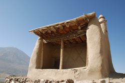
In the morning, Hadar's son led us to Mubarak's last chilehane. It was a short way from the museum and I think the opening had been blocked with a huge stone. Above it was a black stone with Mubarek's inscription in Persian on it. From the stone, we had a perfect view of the tomb against the clear blue morning sky. We climbed up to the tomb, decorated with curved sheep horn patterns. From there we had a view of the valley and mountains, some with deep cracks. Haydar had told Rowshan that the Russians had built an irrigation system that pumped the water up the hill so it could irrigate the hillside. After they left, it couldn't be maintained so now it is gone.
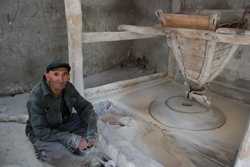
From Yamg, it was a short drive to Vrang. On the way to the Buddhist stuppa, we were joined by some kids. One girl pointed out the town mill. It was water powered. The water was guided into a building where it powered a heavy grinding stone. The whole inside of the building was covered with flour.
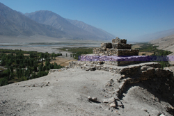
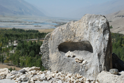
From there we hiked up to the stuppa. It was so strange to see it because it seems so out of place after seeing all the borderline animistic Islamic shrines. It was a square based pyramid built of stones on the hillside. On top was a stone with a rounded indentation. All around it was small white stones so it looks like it has retained some sacred or superstitious significance... or tossing stones in the indentation was a local kids game.
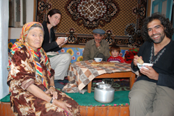
Back down the hill, we stopped by the bazaar looking for bread. The bazaar had very little for sale. Though it had lots of space for people to sell food, there was only one stall with tea, sugar, some cookies and candies. Since everyone makes their own bread, no one sells it. However a man offered to take us to his house where he would give us some. He led us through town to his house where he and his wife served us milk tea which I think is similar to Tibetan butter tea. It is tea with milk but with salt instead of sugar. It made me think a bit of oatmeal without the oats. The bread was some of the tastiest we've had and they gave us a huge half round, apologizing that it wasn't fresh since they had had no electricity for several days. Rowshan tried to pay them and the man put up a fight. Rowshan finally stuck money in his pocket, twice. This is a common problem faced by travelers in the Pamirs. People here are so generous and quick to offer food or a place to stay, yet have so little. Some travelers take advantage of the generosity... maybe because they don't understand the dire situation many of the people here are in.
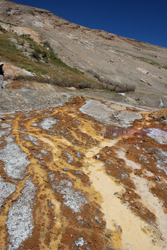
After Vrang, we stopped by some hot springs. I didn't go in but Rowshan took a hot spring shower where the water flowed out of an outdoor pool and dropped into a rusty colored swamp which seeped into the river. I sat watching the mountains, river and sheep. The colors of the area are so harmonious-- the gray blue of the river, rusty gold of the plants, burnt orange of the pools, and blue of the sky.
As we were driving out of one town, we saw a kid who instead of waving as we went by, ran back a little farther from the road even though he was on an embankment safely out of harms way. Zaher explained that when he was little, his father and other parents would tell the kids that if they stood too close to the road, the cars would take them away to Osh where they would be fattened up and eaten. “Ah... that's why the laghman in Osh was so good,” I joked. Zaher said, in this area, the parents still used the story to keep the kids out of the street.
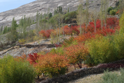
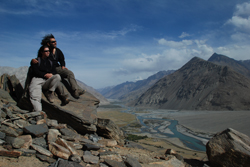
We passed the Zala-i-Panja on the Afghan side of the river and came to the town of Zong where the remains of the Abreshim Qala rested high on the top of a hill. It was a steep walk and the remains weren't too impressive. However, the view made the walk worth while. There were several impressive peaks in Afghanistan--one, a white pyramid. The valley seemed to split creating a space which revealed peaks beyond. Through the mountain gap, where one part of the river flowed and more mountains rose to border the other part of the river. Below the fort was an orchard of trees whose leaves had turned fiery red. Below the mountains spread a flood plain, startling in its flatness at the foot of such high peaks.
We passed the Zala-i-Panja on the Afghan side of the river and came to the town of Zong where the remains of the Abreshim Qala rested high on the top of a hill. It was a steep walk and the remains weren't too impressive. However, the view made the walk worth while. There were several impressive peaks in Afghanistan--one, a white pyramid. The valley seemed to split creating a space which revealed peaks beyond. Through the mountain gap, where one part of the river flowed and more mountains rose to border the other part of the river. Below the fort was an orchard of trees whose leaves had turned fiery red. Below the mountains spread a flood plain, startling in its flatness at the foot of such high peaks.
[ View 1 Comments
|
]


