Going to the Ukayali River
5 October, 2007, 08:40 am in "Peru"
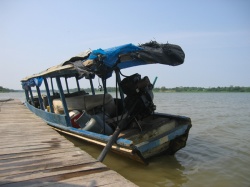
 During the rainy season, there are several canals that link Yarinacocha to the Ukayali River. Right now they are all dry except one. So we are navigating that one which still seems ominously shallow in places, but we've seen larger boats loaded so their top edge is just inches from the water make it through.
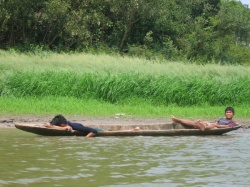
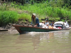
 The channel is hot, not having the breeze which cools the lake. There were boys and men in dugout canoes fishing, boats laden with various items and people, all navigating this small canal.

Boat passing by
The banks are muddy with lots of white and yellow butterflies. There were a few people working on the bank, fishing or doing laundry.

Now we've reached the Ukayali. Originally we were going to go to Iquitos so we could see the Amazon. However, we ended up coming here instead. Lalo reminded me yesterday that the Ukayali actually is the Amazon. Recently the Amazon was determined to be longer than the Nile and therefor the longest river in the world. The reason the length had increased is because before they had been measuring the Amazon from where the Ukayali met another river and became one river named the Amazon. Now they are measuring the Amazon from it's source which is a lake near Arequipa: the source of the Ukayali. So, we are actually on the Amazon... just with a different name. It is big but not vast. Since it is the dry season the waters don't go very far. However, in the rainy season the waters can reach Yarinacocha making it huge. Lalo had showed as an area on the shore of the lake where there used to be a village but 10 years ago it was completely flooded every year by the Ukayali. Now the river has changed its path enough that the area doesn't flood so people are slowly moving back.
Comments
- Comments
Powered by My Blog 1.69. Copyright 2003-2006 FuzzyMonkey.net.
Created by the scripting wizards at FuzzyMonkey.net..
(Code modified by Rowshan Dowlatabadi)
Created by the scripting wizards at FuzzyMonkey.net..
(Code modified by Rowshan Dowlatabadi)

