Chavin
24 September, 2007, 06:25 pm in "Peru"
 We caught the 8AM bus to Chavin. It is a beautiful but difficult road over the mountains.
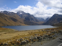
 The first part was through a river plain so it was relatively flat. We went by adobe villages with red tile roofs contrasting against the gold hills. Some of the villages still had ruins from the last big earthquake in the area (1970s). At one point the road sqitched back and we found ourselves facing huge mountain peaks covered with snow
 .
.After driving through a town we began to ascend up narrow roads with stunning views which I eventually opted to ignore, closing my eyes to avoid the combination of nausea and fear invoked by the bus suddenly swerving around potholes caused by falling boulders and getting dangerously close to the edge of the narrow road.
The mountain peaks in the Cordillera Blanca are like nothing I've seen. On some of them you can see the folds in the rocks created when the Andes were forced up into existence. They look almost vertical where in the Rockies they are more diagonal.
Chavin is a pleasant village: clean and well taken care of. The Plaza de Armes has gardens, a fountain and buildings that looked like many had been recently painted.
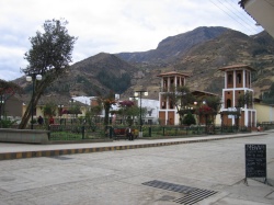
We stopped by the tourist office to find out about return busses. The agent also informed us about shared station waggons leaving for Huaraz whenever they were full.
The road from the plaza to the ruins was lined with souvenire shops and tourist restaurants serving Cuy Picante (Spicy Guinea Pig), the local specialty.
It seemed like we were the first tourists to arrive at the ruins for the day. Unfortunately there weren't any English speaking guides.
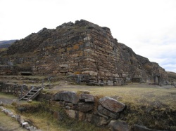
As we followed the signs around the perimeter of the ruins, I began to worry we had been on a bus for 2 and a half hours for ruined stone walls. Fortunately the path reached the opposite side of the ruins which revealed a huge courtyard. There were some underground tunnels visible and lots of heavy stone walls but no carvings. The tunnels weren't lit so we didn't want to explore them. The path wound around to some stairs with snakes carved on them. Then we walked by the entrance to the temple: two carved columns with a carved head stone
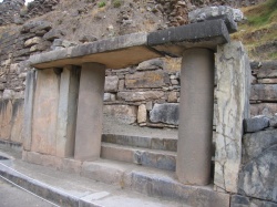 .
. The carvings were strange and hard to comprehend. I could make out claws and what looked like lots of teeth but they didn't seem to make a logical figure: just strange swirling lines and parts. Back at the entrance I glanced at a photocopy of someones article about how all the different parts represented different symbols.
Another stairway led to the tunnels into the interior of the temple. The tunnels were labyrinthine with dead ends and lots of passages all built from heavy stones.
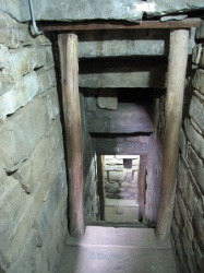
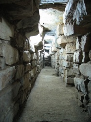
There were windows that looked into other passages. One led to a huge carved pillar but we couldn't get close to it. It is believed that the temple was used to "shock and awe" people into submission to the the priests who became the dominant power in Chavin society. The people would be fed San Pedros cactus and then led into the tunnels where the priests would confuse them with polished coal mirrors, lights shining through the various tunnels and sounds. After going down a stairway to the outside of the ruins, we finally found one of the famed headstones
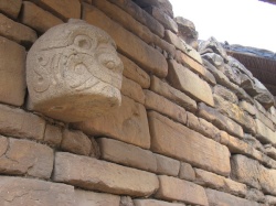 .
. Originally there had been many spaced all around the outside of the temple. Now all except one, have been moved to museums. Even most of the headstones on the scale model of how the original temple had been have been taken!
As we walked around the ruins we heard horn music. Across the river from the ruins was a house where musicians were playing. We could make out bright colored clothing so perhaps it was a celebration. On the hill over one part of the ruins was a small herd of llamas grazing peacefully. The ruins are nestled in a peaceful location with the mountains rising above.
After visiting the ruins we walked back through town and got into one of the shared taxis. Eventually we had enough people and set off. On the way out of town we picked up an old woman with a net bag with 2 live chickens. One of the other passengers moved to the back with the chickens. Rowshan pulled the chicken bag out from under his legs when he noticed the poor chickens were being used as a pillow.
The ride back was faster and more comfortable though it was still a bit rough swerving around the potholes.
At one point the driver pointed to a mountain side where a land slide had happened 50 years before. Now it was full of trees. "Plan de Peru," he said. Sure enough, it did look like a map of Peru traced in green onto the mountain side
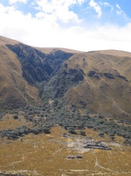 .
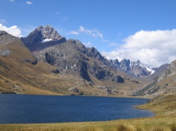
. Beyond it was a beautiful lake and yet another stunning peak.
Comments
- Comments
Powered by My Blog 1.69. Copyright 2003-2006 FuzzyMonkey.net.
Created by the scripting wizards at FuzzyMonkey.net..
(Code modified by Rowshan Dowlatabadi)
Created by the scripting wizards at FuzzyMonkey.net..
(Code modified by Rowshan Dowlatabadi)

